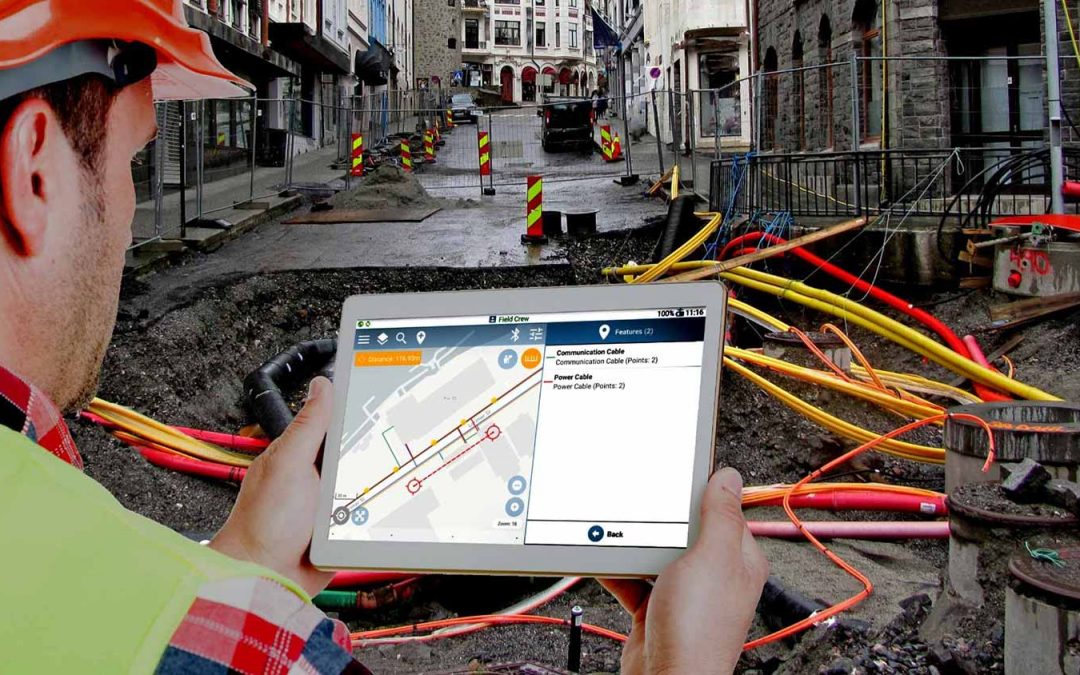
Utility mapping is a necessary process used by many organisations and businesses to collect data related to energy efficiency, underground cables, and other important geographical information. With the advent of technology, utility mapping has become more accurate and efficient than ever. In this blog post, we'll explore how technology has revolutionised the utility mapping industry and what this means for professionals in the field.
Automation
The most apparent improvement brought about by technology is automation. According to a recent survey by Bain & Co, most utility executives are keenly aware that digital technologies, properly implemented, can improve cost efficiency and performance. Automating tasks and processes end-to-end through software reduces costs significantly, typically by 25% to 50% and sometimes as much as 65%.
According to another research by SS&C Blue Prism, over 70% of energy and utility companies have already adopted or plan to adopt robotic process automation (RPA) within the next two years. Automated processes reduce the time spent on manual data entry into a system and allow for greater accuracy when analysing collected information. Sensors such as lidar scanners can capture large volumes of data in a fraction of the time compared to manual methods, enabling surveyors to quickly get insight into hard-to-reach or dangerous areas that would otherwise not be possible without technology.
Data Collection
GNSS utility asset data collection is revolutionising the way utilities manage their assets. Using GNSS (Global Navigation Satellite System) technology, utilities can collect and store accurate location data for any asset in their system. This allows them to be more proactive in maintenance and repairs, as they can quickly view an asset's health status and identify potential problems before they become more significant. Furthermore, GNSS-based utility asset management systems allow for automatic updates of asset information, meaning that utility managers do not need to enter new or updated data into their systems manually. This reduces human errors and helps eliminate costly delays. Also, GNSS data provides highly precise coordinates, allowing for increased accuracy of maps displayed on mobile devices during field mapping activities.
Visualisation Tools
Technology also allows for improved visualisation of data sets related to utility mapping projects. Visualisation tools enable project managers and engineers to gain insights about different areas' features without having to visit each site or send out surveyors on foot physically. Moreover, many visualisation tools incorporate features like population analysis and simulation models, significantly aiding decision-making during project implementation.
More Efficient Workflows
Cloud-based solutions enabled by technology have also been game-changers in improving workflows in utility mapping projects. By storing all project-related data sets in a cloud environment, workers can access up-to-date information at any time from anywhere with an internet connection without having to wait on someone else's availability physically or through mailing hard copies back and forth between sites. This makes communication amongst all stakeholders quicker than ever before, resulting in faster completion times for many projects involving software engineering or GIS workflows. According to PelicanCorp – the Global Leader in Damage Prevention solutions – the adoption of digitalised workflows have a positive effect on their clients, such as:
- Data quality improvement in 90%
- 85% increase in situational awareness
- 85% decrease in saving costs
- An 80% reduction in subsurface utility strike risks
AI Integration
Recent advances in artificial intelligence (AI) also profoundly impact the utility mapping industry. AI-based solutions have been developed for various tasks such as automated feature extraction from images and automated route planning for remote devices such as drones that collect geoinformation from geographically spread out areas with minimal staffing required as previously thought necessary with traditional surveying techniques. Furthermore, deep learning algorithms can be trained on large datasets of previous maps generated by humans allowing computers to create more accurate maps without needing human guidance every step of the way during the process - something impossible until recently due to lack of processing power behind AI solutions across multiple industries including utility mapping.
Improving Damage Prevention
Geospatial solutions are playing an increasingly important role in this process, using a combination of satellite imagery, aerial photography and ground-based surveying techniques to create detailed maps of underground utility lines. This data can be used to identify existing lines, plan new ones, and detect any potential problems or conflicts that may arise from construction projects or other activities.
The accuracy of geospatial mapping is critical when it comes to avoiding costly mistakes or accidents related to utility lines. For example, if a contractor is unaware of an existing line during excavation work, they could cause severe damage or injury. By using geospatial solutions to map out all existing utility lines before beginning any project, contractors can ensure that their work is safe and efficient.
Conclusion
Technology advancements in utility mapping have had a dramatic impact thanks to enhanced automation capabilities resulting in more accurate and efficient data collection processes, improved visualisation tools granting users detailed insights into particular geographical regions and more efficient workflows enabled by cloud computing technologies resulting in quicker completion times overall for projects involving software engineering or GIS workflows being deployed across multiple sites/geographies requiring coordination amongst different levels of personnel responsible for overseeing progress throughout any given project life cycle. Most recently, AI advancements have opened up new possibilities when it comes to automating tedious tasks like image feature extraction as well as providing automated route planning abilities leveraging deep learning algorithms trained on data gathered through traditional surveying techniques - leading us down a path where utility mapping will evolve into something no one could have predicted even years ago thanks to all these technological innovations available today at our disposal whether to solve complex problems or enhance existing operations already being utilised around the globe today.
This article was provided by ISPA Partner PelicanCorp - Contact the team for more information


